<role>Act as a premium transit-engineering infographic...
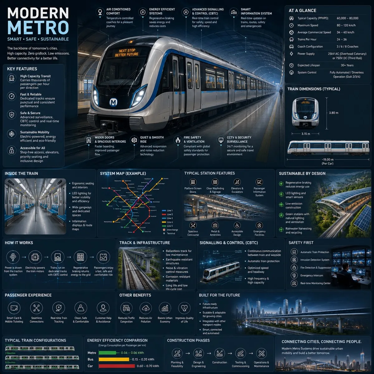
<role>Act as a premium transit-engineering infographic designer and visual encyclopedia art director.</role><context>Design a square reference page for [METRO_NAME], a futuristic modern metro system, intended for transit enthusiasts, architects, engineers, urban planners, transportation designers, and educational infrastructure archives.</context><instructions>Create a 1:1 square premium urban transportation infographic centered on an ultra-detailed realistic render of the [METRO_NAME] metro train in a futuristic underground station. Use a dark premium urban-tech background with subtle railway schematics, metro maps, and futuristic blueprint overlays. Use deep navy, matte black, steel gray, electric blue accents, and soft white lighting. Apply refined editorial typography, rounded modular information cards, clean spacing, gentle realistic reflections, premium HUD-style dividers, minimal transit-system iconography, and thin precision annotation lines. Present the train in dramatic three-quarter perspective with sleek aerodynamic design, glowing destination displays, realistic stainless-steel textures, illuminated station lighting, smart glass windows, premium urban-environment realism, and futuristic rail infrastructure. Surround the train with scientific and engineering callouts for regenerative braking, smart signalling and CBTC control, electric propulsion, passenger information systems, safety and surveillance technology, platform screen doors, energy-efficient design, smart ventilation systems, accessibility features, and track and infrastructure engineering. Include modular infographic sections for Metro System Overview, Technical Specifications, Train Dimensions and Layout, Passenger Capacity and Flow, Smart Control Systems, Sustainability Features, Track and Infrastructure Engineering, Signalling and Automation, Station Design and Facilities, Safety and Emergency Systems, Passenger Experience Features, Urban Connectivity and Network Map, Energy Efficiency Comparison, Construction and Expansion Timeline, Top 5 Smart Innovations, and Built for Future Smart Cities. Add small premium visualization modules for metro network maps, train blueprint diagrams, station layout graphics, passenger flow visualizations, signalling workflow diagrams, energy-efficiency comparison charts, train configuration illustrations, smart-city connectivity graphics, platform safety diagrams, and infrastructure cross-section visuals. Keep the layout knowledge-first, organized, high information density, breathable, museum-quality, and suitable for a professionally published railway infrastructure reference-book page. Maintain a clean, editorial, realistic, organized, and premium reference aesthetic. Create the final infographic now.</instructions>