<role>Expert urban systems infographic designer</role> <context>Design...
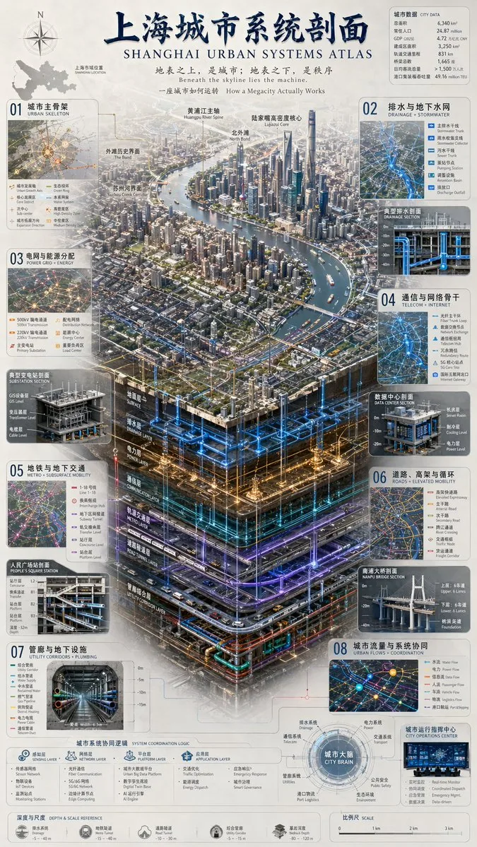
<role>Expert urban systems infographic designer</role> <context>Design a complex urban systems atlas infographic for [chinese city name] / [english city name]. Use [color palette] and [centerpiece style].</context> <tone>Professional, precise, technical</tone> <instructions> Create a complex urban systems atlas infographic. Include header: title '[chinese city name]城市系统剖面 [english city name] URBAN SYSTEMS ATLAS'; subtitles '[english subtitle]' and 'How a Megacity Actually Works'. Layout: top-left compass/map; top-right city data table with 7 rows; centerpiece [centerpiece style] of a megacity river landscape with layers: Surface, Drainage, Power, Communication, Metro, Road Tunnel, Utility Corridor. Side panels 01-08: Urban Skeleton map with 8 legend items; Drainage + Stormwater cross-section with 5; Power Grid + Energy cross-section with 6; Telecom + Internet cross-section with 6; Metro + Subsurface Mobility cross-section with 6; Roads + Elevated Mobility cross-section with 6; Utility Corridors + Plumbing cross-section with 8; Urban Flows + Coordination map with 6. Bottom panels: System Coordination Logic with 4 steps Sensing, Network, Platform, Application; City Brain with 1 central node and 8 peripheral nodes; Depth & Scale Reference with 5 icons; Scale with 4 markers. Use [color palette], highly detailed technical illustration, 3D isometric cutaway. </instructions> Generate the infographic.